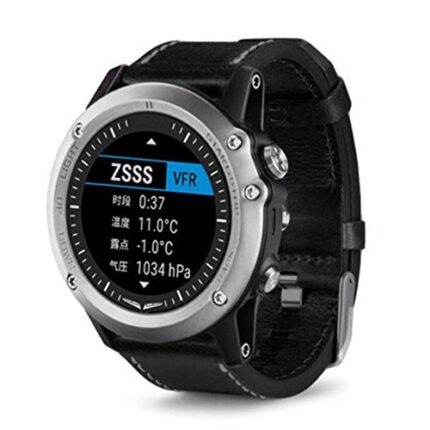
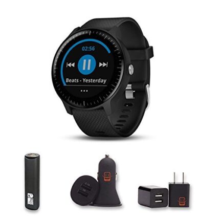
Vivosmart® HR(FITNESS WATCH)
Garmin Vivosmart HR is one of a select few wearables on the market today that attempts to service
functions of both a fitness tracker and a smart watch.
Sleek band is comfortable to wear all day, and the always-on display shows your stats, even in sunlight
Displays steps, distance, calories, heart rate, floors climbed and activity intensity
Receive text, call, email, calendar and social media alerts²
Control your music and your VIRB® action camera (sold separately) all from your wrist
Reminds you to stay active with move bar and vibration alert
Water-resistant
Good battery life
Description
Garmin Vivosmart HR is one of a select few wearables on the market today that attempts to service
functions of both a fitness tracker and a smart watch.
Sleek band is comfortable to wear all day, and the always-on display shows your stats, even in sunlight
Displays steps, distance, calories, heart rate, floors climbed and activity intensity
Receive text, call, email, calendar and social media alerts²
Control your music and your VIRB® action camera (sold separately) all from your wrist
Reminds you to stay active with move bar and vibration alert
Water-resistant
Good battery life
Related products
-
Garmin GPSMAP 78s
0 out of 5(0)Garmin GPSMAP 78s Kenya for boaters and watersports enthusiasts who want to run with the best, the rugged GPSMAP 78s features a 3-axis compass, barometric altimeter, crisp color mapping, high-sensitivity receiver, new molded rubber side grips, plus a microSD™ card slot for loading additional maps. And it floats!
-
Garmin eTrex 10
0 out of 5(0)Garmin eTrex 10
Rugged Handheld GPS with Enhanced Capabilities
- Worldwide basemap
- 2.2″ monochrome display, easy to read in any light
- GPS and GLONASS satellites for faster positioning
- Paperless geocaching
- 25-hour battery life with 2 AA batteries
eTrex 10 retains the core functionality, rugged construction, affordability and long battery life that made eTrex the most dependable GPS device available. We improved the user interface and added a worldwide basemap, paperless geocaching and support for spine-mounting accessories.
-
Garmin GPSMAP 65s
0 out of 5(0)General
DIMENSION 2.4″ x 6.3″ x 1.4″ (6.1 x 16.0 x 3.6 cm) DISPLAY SIZE 1.43″ x 2.15″ (3.6 x 5.5 cm); 2.6″ diag (6.6 cm) DISPLAY RESOLUTION 160 x 240 pixels DISPLAY TYPE transflective, 65K color TFT WEIGHT 7.7 oz (217 g) with batteries BATTERY TYPE 2 AA batteries (not included); NiMH or Lithium recommended BATTERY LIFE 16 hours WATERPROOF IPX7 INTERFACE high speed mini USB and NMEA 0183 compatible MEMORY/HISTORY 16 GB (user space varies based on included mapping) Maps & Memory
PRELOADED MAPS yes (TopoActive; routable) ABILITY TO ADD MAPS BASEMAP AUTOMATIC ROUTING (TURN BY TURN ROUTING ON ROADS) FOR OUTDOOR ACTIVITIES MAP SEGMENTS 3000 BIRDSEYE 250 BirdsEye Imagery files INCLUDES DETAILED HYDROGRAPHIC FEATURES (COASTLINES, LAKE/RIVER SHORELINES, WETLANDS AND PERENNIAL AND SEASONAL STREAMS) INCLUDES SEARCHABLE POINTS OF INTERESTS (PARKS, CAMPGROUNDS, SCENIC LOOKOUTS AND PICNIC SITES) DISPLAYS NATIONAL, STATE AND LOCAL PARKS, FORESTS, AND WILDERNESS AREAS EXTERNAL MEMORY STORAGE yes (32 GB max microSD™ card) WAYPOINTS/FAVORITES/LOCATIONS 5000 TRACKS 200 NAVIGATION TRACK LOG 10000 points, 200 saved tracks NAVIGATION ROUTES 200, 250 points per route; 50 points auto routing Sensors
HIGH-SENSITIVITY RECEIVER GPS GLONASS GALILEO QZSS BAROMETRIC ALTIMETER COMPASS Yes (tilt-compensated 3-axis) GPS COMPASS (WHILE MOVING) MULTI-BAND FREQUENCY SUPPORT Daily Smart Features
SMART NOTIFICATIONS ON HANDHELD VIRB® REMOTE PAIRS WITH GARMIN CONNECT™ MOBILE Outdoor Recreation
POINT-TO-POINT NAVIGATION AREA CALCULATION HUNT/FISH CALENDAR SUN AND MOON INFORMATION GEOCACHING-FRIENDLY Yes (Paperless) CUSTOM MAPS COMPATIBLE yes (500 custom map tiles) PICTURE VIEWER Outdoor Applications
COMPATIBLE WITH GARMIN EXPLORE™ APP GARMIN EXPLORE WEBSITE COMPATIBLE Connections
CONNECTIONS WIRELESS CONNECTIVITY yes (BLUETOOTH®, ANT+®) -
Garmin Montana 700i
0 out of 5(0)Garmin Montana 700i Rugged GPS Touchscreen Navigator with inReach® Technology
General
DIMENSION 3.6″ x 7.2″ x 1.3″ (9.19 x 18.30 x 3.27 cm) TOUCHSCREEN DISPLAY SIZE 2.55″W x 4.25″H (6.48 x 10.80 cm); 5″ diag (12.70 cm) DISPLAY RESOLUTION 480 x 800 pixels DISPLAY TYPE WVGA transflective, dual orientation WEIGHT 14.5 oz (410 g) with included lithium-ion battery pack BATTERY TYPE rechargeable lithium-ion (included) BATTERY LIFE GPS Mode: up to 18 hours
GPS Mode, 10 min Tracking: up to 18 hours
Expedition Mode: up to 330 hours
Expedition Mode, 30 min Tracking: up to 300 hoursWATERPROOF IPX7 MIL-STD-810 yes (thermal, shock, water, vibe) INTERFACE high speed micro USB and NMEA 0183 compatible MEMORY/HISTORY 16 GB (user space varies based on included mapping) Maps & Memory
PRELOADED MAPS yes (TopoActive, by Region; City Navigator Maps, North America; Federal Public Lands Map, US only) ABILITY TO ADD MAPS BASEMAP AUTOMATIC ROUTING (TURN BY TURN ROUTING ON ROADS) FOR OUTDOOR ACTIVITIES AUTOMATIC ROUTING (TURN BY TURN ROUTING ON ROADS) FOR MOTORIZED VEHICLES MAP SEGMENTS 15000 BIRDSEYE yes (direct to device) INCLUDES DETAILED HYDROGRAPHIC FEATURES (COASTLINES, LAKE/RIVER SHORELINES, WETLANDS AND PERENNIAL AND SEASONAL STREAMS) INCLUDES SEARCHABLE POINTS OF INTERESTS (PARKS, CAMPGROUNDS, SCENIC LOOKOUTS AND PICNIC SITES) DISPLAYS NATIONAL, STATE AND LOCAL PARKS, FORESTS, AND WILDERNESS AREAS EXTERNAL MEMORY STORAGE yes (32 GB max microSD™ card) WAYPOINTS/FAVORITES/LOCATIONS 10000 TRACKS 250 NAVIGATION TRACK LOG 20000 points, 250 saved gpx tracks, 300 saved fit activities NAVIGATION ROUTES 250, 250 points per route; 50 points auto routing RINEX LOGGING Sensors
HIGH-SENSITIVITY RECEIVER GPS GALILEO BAROMETRIC ALTIMETER COMPASS Yes (tilt-compensated 3-axis) GPS COMPASS (WHILE MOVING) Daily Smart Features
CONNECT IQ™ (DOWNLOADABLE WATCH FACES, DATA FIELDS, WIDGETS AND APPS) SMART NOTIFICATIONS ON HANDHELD WEATHER VIRB® REMOTE PAIRS WITH GARMIN CONNECT™ MOBILE ACTIVE WEATHER Safety and Tracking Features
LIVETRACK Outdoor Recreation
POINT-TO-POINT NAVIGATION AREA CALCULATION HUNT/FISH CALENDAR SUN AND MOON INFORMATION XERO™ LOCATIONS GEOCACHING-FRIENDLY yes (Geocache Live) CUSTOM MAPS COMPATIBLE yes (500 custom map tiles) PICTURE VIEWER LED BEACON FLASHLIGHT inReach® Features
INTERACTIVE SOS SEND AND RECEIVE TEXT MESSAGES TO SMS AND EMAIL SEND AND RECEIVE TEXT MESSAGES TO OTHER INREACH DEVICE EXCHANGE LOCATIONS WITH OTHER INREACH DEVICE MAPSHARE COMPATIBLE WITH TRACKING VIRTUAL KEYBOARD FOR CUSTOM MESSAGING SEND WAYPOINTS TO MAPSHARE DURING TRIP SEND ROUTE SELECTION TO MAPSHARE DURING TRIP INREACH REMOTE COMPATIBLE Outdoor Applications
COMPATIBLE WITH GARMIN EXPLORE™ APP GARMIN EXPLORE WEBSITE COMPATIBLE DOG TRACKING yes (when paired to compatible dog track system) Connections
CONNECTIONS WIRELESS CONNECTIVITY yes (Wi-Fi®, BLUETOOTH®, ANT+®) -
Garmin Oregon 650 GPS
0 out of 5(0)More Features, More Satellite Power Behind a Tough, Bright Touchscreen
- 3-inch sunlight-readable touchscreen display with dual orientation
- 8 megapixel autofocus camera with LED flash/torch
- Worldwide basemap with shaded relief
- 3-axis compass with accelerometer and barometric altimeter sensors
- Dual battery system — 2 AA batteries or included rechargeable internal NiMH pack
With high-sensitivity GPS and GLONASS satellite tracking, worldwide basemap with shaded relief and customizable buttons for 1-touch image capture and way point marking, Oregon 650 opens a new world of GPS mapping and positioning.
-
Garmin eTrex 32x
0 out of 5(0)Rugged Handheld GPS with Compass and Barometric Altimeter
General
DIMENSION 2.1″ x 4.0″ x 1.3″ (5.4 x 10.3 x 3.3 cm) DISPLAY SIZE 1.4″ x 1.7″ (3.5 x 4.4 cm); 2.2″ diag (5.6 cm) DISPLAY RESOLUTION 240 x 320 pixels DISPLAY TYPE 2.2″ transflective, 65K color TFT WEIGHT 5 oz (141.7 g) with batteries BATTERY TYPE 2 AA batteries (not included); NiMH or Lithium recommended BATTERY LIFE 25 hours WATERPROOF IPX7 INTERFACE mini USB MEMORY/HISTORY 8 GB Maps & Memory
PRELOADED MAPS yes (TopoActive; routable) ABILITY TO ADD MAPS BASEMAP AUTOMATIC ROUTING (TURN BY TURN ROUTING ON ROADS) FOR OUTDOOR ACTIVITIES MAP SEGMENTS 3000 BIRDSEYE 250 BirdsEye Imagery files INCLUDES DETAILED HYDROGRAPHIC FEATURES (COASTLINES, LAKE/RIVER SHORELINES, WETLANDS AND PERENNIAL AND SEASONAL STREAMS) INCLUDES SEARCHABLE POINTS OF INTERESTS (PARKS, CAMPGROUNDS, SCENIC LOOKOUTS AND PICNIC SITES) DISPLAYS NATIONAL, STATE AND LOCAL PARKS, FORESTS, AND WILDERNESS AREAS EXTERNAL MEMORY STORAGE yes (32 GB max microSD™ card) WAYPOINTS/FAVORITES/LOCATIONS 2000 TRACKS 200 NAVIGATION TRACK LOG 10000 points, 200 saved tracks NAVIGATION ROUTES 200 routes, 250 points per route; 50 points auto routing Sensors
HIGH-SENSITIVITY RECEIVER GPS GLONASS BAROMETRIC ALTIMETER COMPASS Yes (tilt-compensated 3-axis) GPS COMPASS (WHILE MOVING) Daily Smart Features
VIRB® REMOTE Outdoor Recreation
POINT-TO-POINT NAVIGATION AREA CALCULATION HUNT/FISH CALENDAR SUN AND MOON INFORMATION GEOCACHING-FRIENDLY Yes (Paperless) CUSTOM MAPS COMPATIBLE yes (100 custom map tiles) PICTURE VIEWER Connections
CONNECTIONS WIRELESS CONNECTIVITY yes (ANT+®)