Brands
-
Garmin eTrex 10 Kenya
Rugged Handheld GPS with Enhanced Capabilities
- Worldwide basemap
- 2.2″ monochrome display, easy to read in any light
- GPS and GLONASS satellites for faster positioning
- Paperless geocaching
- 25-hour battery life with 2 AA batteries
eTrex 10 Kenya retains the core functionality, rugged construction, affordability and long battery life that made eTrex the most dependable GPS device available. We improved the user interface and added a worldwide basemap, paperless geocaching and support for spine-mounting accessories.
See the Way
eTrex 10 has an enhanced 2.2″ monochrome display that’s easy to read in any lighting situation. Both durable and water resistant, eTrex 10 is built to withstand the elements. Its easy-to-use interface means you’ll spend more time enjoying the outdoors and less time searching for information. eTrex 10 features the legendary toughness that’s built to withstand the elements. Dust, dirt, humidity, water — none are a match for this navigator.
Find Fun
eTrex 10 supports geocaching GPX files for transferring geocaches. Visit OpenCaching to start your geocaching adventure. By going paperless, you’re not only helping the environment but also improving efficiency. eTrex 10 stores and displays key information, including location, terrain, difficulty, hints and descriptions, which means no more manually entering coordinates and paper printouts. Simply upload the GPX file to your eTrex 10 and start hunting for caches.
Keep Your Fix
With its high-sensitivity, WAAS-enabled GPS receiver and HotFix® satellite prediction, eTrex 10 locates your position quickly and precisely and maintains its GPS location even in heavy cover and deep canyons. Whether you’re in deep woods or just near tall buildings and trees, you can count on eTrex 10 to help you find your way when you need it the most.
Go Global
eTrex devices are the first-ever consumer-grade receivers that can track both GPS and GLONASS satellites simultaneously. When using GLONASS satellites, the time it takes for the receiver to “lock on” to a position is (on average) approximately 20 percent faster than using GPS. And when using both GPS and GLONASS, the receiver has the ability to lock on to 24 more satellites than using GPS alone.
KSh15,999.00Buy via WhatsApp Compare -
All New Garmin Aera 500
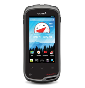
4.3-inch touchscreen display
Fast 5 Hz GPS refresh rate
Map display with terrain and obstacle warnings
Street navigation with preloaded maps -
Garmin Aera 550
Enjoy High-resolution Navigation
- 4.3″ touchscreen display
- Fast 5 Hz GPS refresh rate
- High-resolution map display
- Terrain and obstacle warnings
- Advanced street navigation
-
GARMIN AERA 660 | HANDHELD/PORTABLE AVIATION GPS
- Advanced Capabilities in a Portable Package
- Rugged, purpose-built portable navigator with built-in GPS/GLONASS receiver and 5-inch sunlight-readable screen
- Intuitive, simple touchscreen operation and single power button make getting around the display a cinch
- 3D Vision perspective view shows terrain, obstacles, airport environment, optional traffic, nearest airport and more
- Wireless cockpit connectivity via Connext® streams weather and traffic from compatible devices
- Cut the cord and database prices with Wi-Fi® database downloads and the affordable Garmin Navigation Database
Physical & Performance
- Physical dimensions: 5.5”W x 3.4”H x .8”D (14.1 x 8.7x 2.1 cm)
- Display size, WxH: 4.35″W x 2.61″H (11.1 x 6.6 cm); 5.08″ diag (12.9cm)
- Display resolution, WxH: 480 x 800; portrait and landscape orientation
- Display type: touchscreen WVGA color TFT with white backlight
- Weight: 8.64 ounces (245 g) with battery; 7.23 ounces (205 g) without battery
- Battery: removable, rechargeable lithium-ion
- Battery life: Up to 4 hours during most daytime conditions, (80% backlight) and wireless connectivity in the cockpit, e.g. GTX 345; up to 6 hours during typical nighttime conditions, (5% backlight) and without wireless connectivity.
- SBAS/WAAS/GLONASS receiver: high sensitivity with WAAS position accuracy
- Voltage range: 10-35
- IFR or VFR: VFR
- Traffic Information Services (TIS) alerts compatible: yes
- Accepts data cards: yes (microSD™ cards)
-
GARMIN AERA 760
7 INCH TOUCHSCREEN PORTABLE GPS NAVIGATOR
Features
- Garmin WireAware™
- Internet Weather
- Automatic Data Downloads
- Up to 4 Hours Battery Life
- Connext®
- TargetTrend™ (When paired with compatible devices)
- TerminalTraffic™ (When paired with compatible devices)
- Smart Airspace
- 3D Vision with Virtual Behind-the-Aircraft Perspective View
- 3D Representation of Surrounding Terrain and Obstacles
Specifications
Physical dimensions: 7.29”W x 4.85”H x 0.91”D (18.5 x 12.3x 2.3 cm)
Display size: 7″ diag (17.8 cm)
Display resolution: WxH: 480 x 800; portrait and landscape orientation
Display type: touchscreen WVGA color TFT with white backlight
Weight: 19.8 oz (561 g)
Battery: Rechargeable lithium-ion
Battery life: Up to 4 hours during most daytime conditions, (80% backlight)
SBAS/WAAS/GLONASS receiver: high-sensitivity with WAAS position accuracy
Voltage range: 10-35
IFR or VFR: VFR/IFR
USB connection: yes (USB-C)
Expandable memory: yes (microSD™ cards)Compatible Interfaces
- Send and Receive Flight Plan Data
- GTN 650Xi/750Xi
- GTN 650/750
- GPS 175
- Transfer Frequencies and Airport Identifiers
- SL 30 / 40
- GTR 225
- GNC 255
- GTR 200
- Couple to Select Autopilots for VFR Navigation
- Fly lateral GPS
- Single Point Vertical Navigation (VNAV) Guidance
- Receive AHRS Information
- GTX 345 Transponder
- GNX 375 Transponder/Navigator
- GDL 50 Series
- GDL 39 3D
- ADS-B Traffic Information
- GTX 345 Transponder
- GNX 375 Navigator/Transponder
- GDL 50 and GDL 52 Datalink
- GDL 39 Series Datalink
- FIS-B Sources
- GDL 50 or GDL 52 Datalink Receiver (GGDL 51 or 52 provide SiriusXM Satellite Weather)
- GDL 39 Series Datalink
- GTX 345 Transponder
- GNX 375 Navigator/Transponder
In The Box
- Garmin aera 760
- Mount cradle with CLA power cable
- USB-C 27W AC adapter
- USB-C to USB-C cable
- USB-C to USB-A cable
- Quick start manual and related documentation
-
Garmin Aera 796
SPECIFICATIONS
PHYSICAL & PERFORMANCE
5.1″W x 8.0″H x 1.5″D DISPLAY SIZE: 3.6″W x 6.0″H, 7.0″ Diagonal, 480 x 800 pixel resolution DISPLAY TYPE: dual-oriented, bright, color WVGA TFT with adjustable backlighting & selectable screen orientation WEIGHT: 26.4 oz with battery pack BATTERY: rechargeable, replaceable Lithium-ion BATTERY LIFE: up to 3 hours with full backlight and GXM 40 connected (8 hours with 50% backlight) WATERPROOF: no VOLTAGE RANGE: 11-40 SBAS/WAAS RECEIVER: high sensitivity with WAAS position accuracy IFR OR VFR: VFR MAPS, DATABASES & MEMORY:
BASEMAP: Yes NAVIGATION DATABASE (INCLUDES JEPPESEN DATA): Yes TYPES OF JEPPESEN DATA: full & ARTCC, FSS frequencies, and final approach waypoints NAVIGATION DATABASE COVERAGE AREAS: Americas PRELOADED TERRAIN DATABASE: Yes PRELOADED OBSTACLE DATABASE: Yes (US & Europe only) PRELOADED SAFETAXI AIRPORT DIAGRAMS: Yes (US only) PRELOADED AOPA AIRPORT DIRECTORY: Yes (US only) PRELOADED GARMIN FLITECHARTS: Yes (US only) PRELOADED LOW & HIGH ALTITUDE ENROUTE AIRWAYS: Yes PRELOADED PRIVATE AIRPORTS: Yes (US only) PRELOADED STREET MAPS: No ABILITY TO ADD MAPS: Yes ACCEPTS DATA CARDS: Yes (SD Cards) BUILT-IN MEMORY: Internal Solid State WAYPOINTS/FAVORITES/LOCATIONS: 3,000 ROUTES: 50 FEATURES & BENEFITS:
MOVING MAP: yes PATENTED PANEL PAGE: yes HSI (GPS BASED): yes IFR MAP MODE: yes TRAFFIC INFORMATION SYSTEMS (TIS) ALERTS COMPATIBLE: yes AUDIBLE TERRAIN ALERTS: yes TERRAIN RESOLUTION: standard SMART AIRSPACE FEATURE: yes AUTOMATIC LOGBOOK: yes SEPARATE SERIAL & USB INTERFACES: yes VOICE PROMPTS: no SPEAKS STREET NAMES: no LANE ASSIST: no 3D MAP VIEW: no BLUETOOTH WIRELESS TECHNOLOGY: no SPEED LIMIT INDICATOR: no TRAFFIC COMPATIBLE: no CUSTOM POIS: no XM WX WEATHER & RADIO: yes IN THE BOX:
STANDARD: aera 796 Yoke mount DC cigarette adapter 12/24 volt cradle Home AC cradle dock XM USB extension cable GA 25 remote antenna with a suction cup mount USB cable Carrying case Touchscreen cleaning cloth Quick reference guide Complimentary single database update Pilot’s Guide e-version (viewable on the document viewer) -
General
DIMENSION 2.4″ x 6.3″ x 1.4″ (6.1 x 16.0 x 3.6 cm) DISPLAY SIZE 1.43″ x 2.15″ (3.6 x 5.5 cm); 2.6″ diag (6.6 cm) DISPLAY RESOLUTION 160 x 240 pixels DISPLAY TYPE transflective, 65K color TFT WEIGHT 7.7 oz (217 g) with batteries BATTERY TYPE 2 AA batteries (not included); NiMH or Lithium recommended BATTERY LIFE 16 hours WATERPROOF IPX7 INTERFACE high speed mini USB and NMEA 0183 compatible MEMORY/HISTORY 16 GB (user space varies based on included mapping) Maps & Memory
PRELOADED MAPS yes (TopoActive; routable) ABILITY TO ADD MAPS BASEMAP AUTOMATIC ROUTING (TURN BY TURN ROUTING ON ROADS) FOR OUTDOOR ACTIVITIES MAP SEGMENTS 3000 BIRDSEYE 250 BirdsEye Imagery files INCLUDES DETAILED HYDROGRAPHIC FEATURES (COASTLINES, LAKE/RIVER SHORELINES, WETLANDS AND PERENNIAL AND SEASONAL STREAMS) INCLUDES SEARCHABLE POINTS OF INTEREST (PARKS, CAMPGROUNDS, SCENIC LOOKOUTS AND PICNIC SITES) DISPLAYS NATIONAL, STATE AND LOCAL PARKS, FORESTS, AND WILDERNESS AREAS EXTERNAL MEMORY STORAGE yes (32 GB max microSD™ card) WAYPOINTS/FAVORITES/LOCATIONS 5000 TRACKS 200 NAVIGATION TRACKLOG 10000 points, 200 saved tracks NAVIGATION ROUTES 200, 250 points per route; 50 points auto-routing Sensors
HIGH-SENSITIVITY RECEIVER GPS GLONASS GALILEO QZSS GPS COMPASS (WHILE MOVING) MULTI-BAND FREQUENCY SUPPORT Daily Smart Features
SMART NOTIFICATIONS ON HANDHELD VIRB® REMOTE PAIRS WITH GARMIN CONNECT™ MOBILE Outdoor Recreation
POINT-TO-POINT NAVIGATION AREA CALCULATION HUNT/FISH CALENDAR SUN AND MOON INFORMATION GEOCACHING-FRIENDLY Yes (Paperless) CUSTOM MAPS COMPATIBLE yes (500 custom map tiles) PICTURE VIEWER Outdoor Applications
COMPATIBLE WITH GARMIN EXPLORE™ APP GARMIN EXPLORE WEBSITE COMPATIBLE Connections
CONNECTIONS WIRELESS CONNECTIVITY yes (BLUETOOTH®, ANT+®) -
General
DIMENSION 2.4″ x 6.3″ x 1.4″ (6.1 x 16.0 x 3.6 cm) DISPLAY SIZE 1.43″ x 2.15″ (3.6 x 5.5 cm); 2.6″ diag (6.6 cm) DISPLAY RESOLUTION 160 x 240 pixels DISPLAY TYPE transflective, 65K color TFT WEIGHT 7.7 oz (217 g) with batteries BATTERY TYPE 2 AA batteries (not included); NiMH or Lithium recommended BATTERY LIFE 16 hours WATERPROOF IPX7 INTERFACE high speed mini USB and NMEA 0183 compatible MEMORY/HISTORY 16 GB (user space varies based on included mapping) Maps & Memory
PRELOADED MAPS yes (TopoActive; routable) ABILITY TO ADD MAPS BASEMAP AUTOMATIC ROUTING (TURN BY TURN ROUTING ON ROADS) FOR OUTDOOR ACTIVITIES MAP SEGMENTS 3000 BIRDSEYE 250 BirdsEye Imagery files INCLUDES DETAILED HYDROGRAPHIC FEATURES (COASTLINES, LAKE/RIVER SHORELINES, WETLANDS AND PERENNIAL AND SEASONAL STREAMS) INCLUDES SEARCHABLE POINTS OF INTERESTS (PARKS, CAMPGROUNDS, SCENIC LOOKOUTS AND PICNIC SITES) DISPLAYS NATIONAL, STATE AND LOCAL PARKS, FORESTS, AND WILDERNESS AREAS EXTERNAL MEMORY STORAGE yes (32 GB max microSD™ card) WAYPOINTS/FAVORITES/LOCATIONS 5000 TRACKS 200 NAVIGATION TRACK LOG 10000 points, 200 saved tracks NAVIGATION ROUTES 200, 250 points per route; 50 points auto routing Sensors
HIGH-SENSITIVITY RECEIVER GPS GLONASS GALILEO QZSS BAROMETRIC ALTIMETER COMPASS Yes (tilt-compensated 3-axis) GPS COMPASS (WHILE MOVING) MULTI-BAND FREQUENCY SUPPORT Daily Smart Features
SMART NOTIFICATIONS ON HANDHELD VIRB® REMOTE PAIRS WITH GARMIN CONNECT™ MOBILE Outdoor Recreation
POINT-TO-POINT NAVIGATION AREA CALCULATION HUNT/FISH CALENDAR SUN AND MOON INFORMATION GEOCACHING-FRIENDLY Yes (Paperless) CUSTOM MAPS COMPATIBLE yes (500 custom map tiles) PICTURE VIEWER Outdoor Applications
COMPATIBLE WITH GARMIN EXPLORE™ APP GARMIN EXPLORE WEBSITE COMPATIBLE Connections
CONNECTIONS WIRELESS CONNECTIVITY yes (BLUETOOTH®, ANT+®) -
Garmin Montana 600 hiking and handheld devices
General
DIMENSION 2.9″ x 5.7″ x 1.4″ (7.48 x 14.42 x 3.64 cm) TOUCHSCREEN DISPLAY SIZE 2″W x 3.5″H (5.06 x 8.93 cm); 4″ diag (10.2 cm) DISPLAY RESOLUTION 272 x 480 pixels DISPLAY TYPE bright, transflective 65K color TFT, dual-orientation touchscreen; sunlight readable WEIGHT 10.2 oz (289 g) with included lithium-ion battery pack; 11.7 oz (333 g) with 3 AA batteries (not included) BATTERY TYPE rechargeable lithium-ion (included) or 3 AA batteries (not included); NiMH or Lithium recommended BATTERY LIFE up to 16 hours (lithium-ion)
up to 22 hours (AA batteries)WATERPROOF IPX7 INTERFACE high-speed mini USB and NMEA 0138 compatible MEMORY/HISTORY 3 GB Maps & Memory
ABILITY TO ADD MAPS BASEMAP AUTOMATIC ROUTING (TURN BY TURN ROUTING ON ROADS) FOR OUTDOOR ACTIVITIES Yes (with optional mapping for detailed roads) MAP SEGMENTS 4000 BIRDSEYE 250 BirdsEye Imagery files INCLUDES DETAILED HYDROGRAPHIC FEATURES (COASTLINES, LAKE/RIVER SHORELINES, WETLANDS AND PERENNIAL AND SEASONAL STREAMS) no (additional mapping needed) INCLUDES SEARCHABLE POINTS OF INTERESTS (PARKS, CAMPGROUNDS, SCENIC LOOKOUTS AND PICNIC SITES) no (additional mapping needed) DISPLAYS NATIONAL, STATE AND LOCAL PARKS, FORESTS, AND WILDERNESS AREAS no (additional mapping needed) EXTERNAL MEMORY STORAGE yes (32 GB max microSD™ card) WAYPOINTS/FAVORITES/LOCATIONS 4000 TRACKS 200 NAVIGATION TRACK LOG 10000 points, 200 saved tracks NAVIGATION ROUTES 200, 250 points per route; 50 points auto routing Sensors
HIGH-SENSITIVITY RECEIVER GPS BAROMETRIC ALTIMETER COMPASS Yes (tilt-compensated 3-axis) GPS COMPASS (WHILE MOVING) Daily Smart Features
VIRB® REMOTE Outdoor Recreation
POINT-TO-POINT NAVIGATION AREA CALCULATION HUNT/FISH CALENDAR SUN AND MOON INFORMATION GEOCACHING-FRIENDLY CUSTOM MAPS COMPATIBLE yes (500 custom map tiles) PICTURE VIEWER -
Garmin Montana 700 Rugged GPS Touchscreen Navigator
General
DIMENSION 3.4″ x 7.2″ x 1.3″ (8.76 x 18.30 x 3.27 cm) TOUCHSCREEN DISPLAY SIZE 2.55″W x 4.25″H (6.48 x 10.80 cm); 5″ diag (12.70 cm) DISPLAY RESOLUTION 480 x 800 pixels DISPLAY TYPE WVGA transflective, dual orientation WEIGHT 14.0 oz (397 g) with included lithium-ion battery pack BATTERY TYPE rechargeable lithium-ion (included) or 3 AA batteries (not included); lithium recommended BATTERY LIFE GPS Mode: up to 18 hours
Expedition Mode: up to 330 hoursWATERPROOF IPX7 MIL-STD-810 yes (thermal, shock, water, vibe) INTERFACE high speed micro USB and NMEA 0183 compatible MEMORY/HISTORY 16 GB (user space varies based on included mapping) Maps & Memory
PRELOADED MAPS yes (TopoActive, by region; Federal Public Lands maps, U.S. only) ABILITY TO ADD MAPS BASEMAP AUTOMATIC ROUTING (TURN BY TURN ROUTING ON ROADS) FOR OUTDOOR ACTIVITIES Yes (with optional mapping for detailed roads) MAP SEGMENTS 15000 BIRDSEYE yes (direct to device) INCLUDES DETAILED HYDROGRAPHIC FEATURES (COASTLINES, LAKE/RIVER SHORELINES, WETLANDS AND PERENNIAL AND SEASONAL STREAMS) INCLUDES SEARCHABLE POINTS OF INTERESTS (PARKS, CAMPGROUNDS, SCENIC LOOKOUTS AND PICNIC SITES) DISPLAYS NATIONAL, STATE AND LOCAL PARKS, FORESTS, AND WILDERNESS AREAS EXTERNAL MEMORY STORAGE yes (32 GB max microSD™ card) WAYPOINTS/FAVORITES/LOCATIONS 10000 TRACKS 250 NAVIGATION TRACK LOG 20000 points, 250 saved gpx tracks, 300 saved fit activities NAVIGATION ROUTES 250, 250 points per route; 50 points auto routing RINEX LOGGING Sensors
HIGH-SENSITIVITY RECEIVER GPS GLONASS GALILEO BAROMETRIC ALTIMETER COMPASS Yes (tilt-compensated 3-axis) GPS COMPASS (WHILE MOVING) Daily Smart Features
CONNECT IQ™ (DOWNLOADABLE WATCH FACES, DATA FIELDS, WIDGETS AND APPS) SMART NOTIFICATIONS ON HANDHELD VIRB® REMOTE PAIRS WITH GARMIN CONNECT™ MOBILE ACTIVE WEATHER Safety and Tracking Features
LIVETRACK Outdoor Recreation
POINT-TO-POINT NAVIGATION AREA CALCULATION HUNT/FISH CALENDAR SUN AND MOON INFORMATION XERO™ LOCATIONS GEOCACHING-FRIENDLY yes (Geocache Live) CUSTOM MAPS COMPATIBLE yes (500 custom map tiles) PICTURE VIEWER INREACH REMOTE WIDGET LED BEACON FLASHLIGHT inReach® Features
INREACH REMOTE COMPATIBLE Outdoor Applications
COMPATIBLE WITH GARMIN EXPLORE™ APP GARMIN EXPLORE WEBSITE COMPATIBLE DOG TRACKING yes (when paired to compatible dog track system) Connections
CONNECTIONS WIRELESS CONNECTIVITY yes (Wi-Fi®, BLUETOOTH®, ANT+®) -
MAP CITY NAVIGATOR
Description
Navigate the streets with confidence. This product provides detailed road maps and points of interest for your device, so you can navigate with exact, turn-by-turn directions to any address or intersection.
- Includes more than 440,000 miles (700,000 km) of roads, including motorways, national and regional thoroughfares and local roads, in Eastern Africa.
- Displays thousands of points of interest throughout the continent, including restaurants, lodging, petrol/gasoline stations, attractions and railways.
- Gives turn-by-turn directions on compatible devices.
- Speaks street names (example: “Turn right on Main Street”).
- Includes navigational features, such as turn restrictions, roundabout guidance and speed categories.
- Contains traffic data for compatible devices that use traffic receivers.