Product Specifications
- Trimble engine 220 channels,Advance multipath navigation, Novatel OEM628 129 channels (optional), GPS/GLONASS/GALILEO, BEIDOU..
- typically less than 10 sec RTK signal initialization
- Satellite signals tracked: GPS: L1 C/A, 2E,L2C,L5, GLONASS: L1 C/A,L1P,L2 C/A,L2P, SBAS: L1 /A,L5
- Initial capture time: less than 15 sec
- Raw measurement & position output: 1,2,5,10,20 Hz selectable update rate
- DGPS/RTCM differential positioning: 0.25 m (RMS)
- Static horizontal accuracy: 2.5 mm ± 0.5 ppm (RMS)
- Static vertical accuracy: 5 mm ± 0.5 ppm (RMS)
- Kinematic horizontal accuracy: 8 mm ± 1 ppm (RMS)
- Kinematic vertical accuracy: 15 mm ± 1 ppm (RMS)
- Serial protocols: RTK formats CMR, CMR+, RTCM 2.x, RTCM 3.x, Navigation outputs ASCII (NMEA-0183) , RTCA (optional)
- Internal memory: 4GB up to 400hrs of 15sec raw GNSS data from 18 satellites, RS232X2, Bluetooth, USB,WIFI,Tilt sensor
Product Description
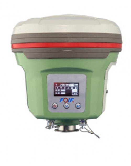
- New generation receiver— Compact, lightweight and handling! Work anywhere and anytime!
- A50 offers features of Wifi to achieve quick and long distance parameters settings and data transferring; Supports professional GNSS Satelite tracking(GPS, Glonass, Galieo, BDS…), 220 channels; Equipped with industry standard GNSS engine(Trimble, NovAtel….) can access to local CORS, OLED display with superior brightness & temperature range Rugged design, IP67; Voice messages make you clear for current work situation without staring any equipment
- smart Design: With the increasing demand for smart-design GNSS, to develop the receiver featured with miniaturization turns into our new goal until today it comes true. It is completely no doubt that small size and light weight design can greatly alleviate general field work and improve productivity a lot.
- Brand new idea: In terms of cellular mobile and wireless system, we tend to introduce more and more creativities into our product. Besides a set of bluetooth, wireless radio and mobile network(2G&3G), we bring in the WIFI function which quite broaden data communications for GNSS.
- Excellent performance: Embedded with high-sensitivity GNSS module , A50 can implement massive surveys:RTK, DGPS, (SBAS) , Static, etc.
- New compact design, GNSS Satellite tracking (GPS, Glonass, Galileo, Beidou..) , centering the pole by built-in sensor.
- A50 automatic data collect during centering & automatic correct tilt error. It is means when you stay in the station, even the instrument still in centering, the A50 collect the data automatically;
- Tilt Sensor function for this tilt feature is when the pole is tilted in ±30 degree, the A30 still could get the right point data by automatic correct system
- Professional GNSS satellite tracking (GPS& GLONASS standard, support to Galileo, Beidou)
- Equipped with industry standard Trimble BD970 board (220 channels)
- FOIF PRS (Portable Reference System) technology, compatible with other brands GNSS products
- 2G, 3G, 3.5G WWAN (HSDPA/WCDMA/EDGE…) module option
- Optional field software of FOIF Survey and FieldGenius to meet you any needs
- Professional GNSS Satellite tracking (GPS, Glonass, Galileo, Beidou..)
- Equipped with industry standard GNSS engine (Trimble, NovAtel..)
- Centering the pole by built-in sensor
- Voice messages
- OLED display with superior brightness & temperature range
- Base and rover communication options to suit any application
- FOIF PRS (Portable Reference System) technology, compatible with other brands GNSS products
- 3.5G WWAN (HSDPA/WCDMA/EDGE…) module
- Tilt sensor Automatic correct system by 30 degree
- Interface; RS232x2 port,USBX1, Bluetooth, EXT Event,Wifi
- Data format CMR,CMR+,RTCM2.X, RTCM3.X, RTCA(optonal)


