Product Specifications
- Trimble engine 220 channels,Advance multipath navigation, Novatel OEM628 129 channels (optional), GPS/GLONASS/GALILEO, BEIDOU..
- typically less than 10 sec RTK signal initialization
- Satellite signals tracked: GPS: L1 C/A, 2E,L2C,L5, GLONASS: L1 C/A,L1P,L2 C/A,L2P, SBAS: L1 /A,L5
- Initial capture time: less than 15 sec
- Raw measurement & position output: 1,2,5,10,20 Hz selectable update rate
- DGPS/RTCM differential positioning: 0.25 m (RMS)
- Static horizontal accuracy: 5 mm ± 0.5 ppm (RMS)
- Static vertical accuracy: 10 mm ± 0.5 ppm (RMS)
- Kinematic horizontal accuracy: 10 mm ± 1 ppm (RMS)
- Kinematic vertical accuracy: 20 mm ± 1 ppm (RMS)
- Serial protocols: RTK formats CMR, CMR+, RTCM 2.x, RTCM 3.x, Navigation outputs ASCII (NMEA-0183) , RTCA (optional)
- Internal memory: 4GB up to 400hrs of 15sec raw GNSS data from 18 satellites, RS232X2, Bluetooth, USB
Product Description
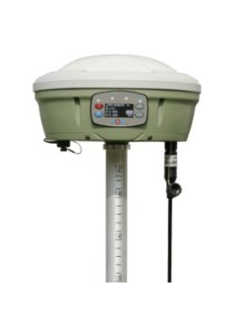
- New compact design, GNSS Satellite tracking (GPS, Glonass, Galileo, Beidou..) , centering the pole by built-in sensor.
- The main feature of A30 will be the automatic data collect during centering & automatic correct tilt error. It is means when you stay in the station, even the instrument still in centering, the A30 collect the data automatically;
- Optional function for this tilt feature is when the pole is tilted in ±30 degree, the A30 still could get the right point data by automatic correct system
- Professional GNSS satellite tracking (GPS& GLONASS standard, support to Galileo, Beidou)
- Equipped with industry standard Trimble BD970 board (220 channels)
- FOIF PRS (Portable Reference System) technology, compatible with other brands GNSS products
- 2G, 3G, 3.5G WWAN (HSDPA/WCDMA/EDGE…) module option
- Optional field software of FOIF Survey and FieldGenius to meet you any needs
- Professional GNSS Satellite tracking (GPS, Glonass, Galileo, Beidou..)
- Equipped with industry standard GNSS engine (Trimble, NovAtel..)
- Centering the pole by built-in sensor
- Voice messages
- OLED display with superior brightness & temperature range
- Base and rover communication options to suit any application
- FOIF PRS (Portable Reference System) technology, compatible with other brands GNSS products
- 3.5G WWAN (HSDPA/WCDMA/EDGE…) module option
- Automatic correct system by 30 degree (optional)
- Interface; RS232x2 port,USBX1, Bluetooth, EXT Event(optional)
- Data format CMR,CMR+,RTCM2.X, RTCM3.X, RTCA(optonal)


